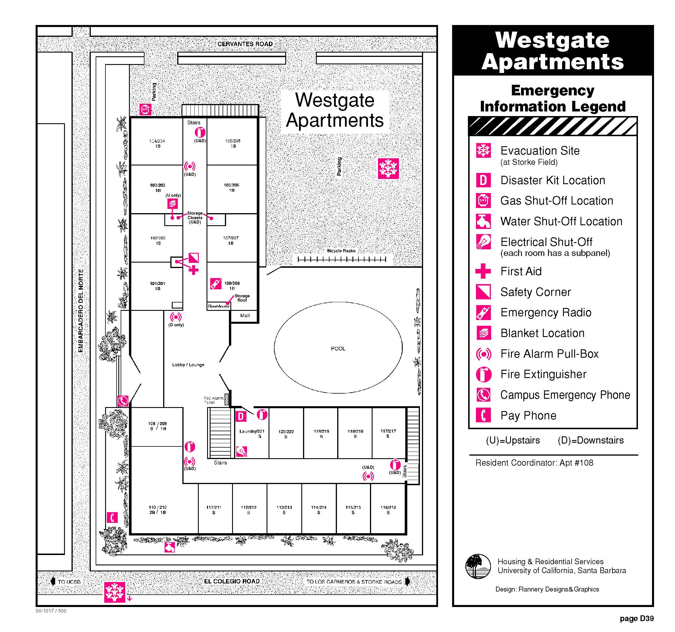
Description
This layout map for Westgate Apartments at UC Santa Barbara provides a general layout plan of the residential complex, emphasizing apartment numbers, surrounding street names, the parking lot, and emergency resource locations.
Building Layout
The complex is a two-story L-shaped structure centered around a shared recreational area:
- Residential Units: Units are numbered for both upstairs (U) and downstairs (D) floors (e.g., 101/201).
- Shared Amenities include a Pool, Lobby/Lounge, Mail area, and Laundry Room.
- Staffing: Live-in Resident Assistant staff are on site to provide additional assistance.
Campus Orientation
The complex is bordered by the following roads:
- South: Cervantes Road
- North: El Colegio Road (leading to Los Carneros and Storke Roads).
- East: Embarcadero Del Norte
Emergency Evacuation Sites
The map identifies two emergency assembly points:
- Primary Site: Parking area to the south of the pool
- Secondary Site: North across El Colegio Road towards Storke Field.
Safety and Utilities Legend
Critical safety equipment and utility shut-offs are clearly marked throughout the complex:
- Medical Resources: First Aid Kits and Disaster Kits are identified.
- Utility Shut-offs are marked for Gas, Water, and Electrical.
- Fire Safety: Fire Hydrants (H) and Fire Extinguishers are positioned strategically around and within the building.
- Communication: Residents have access to Emergency Phones and Emergency Radios.