Description
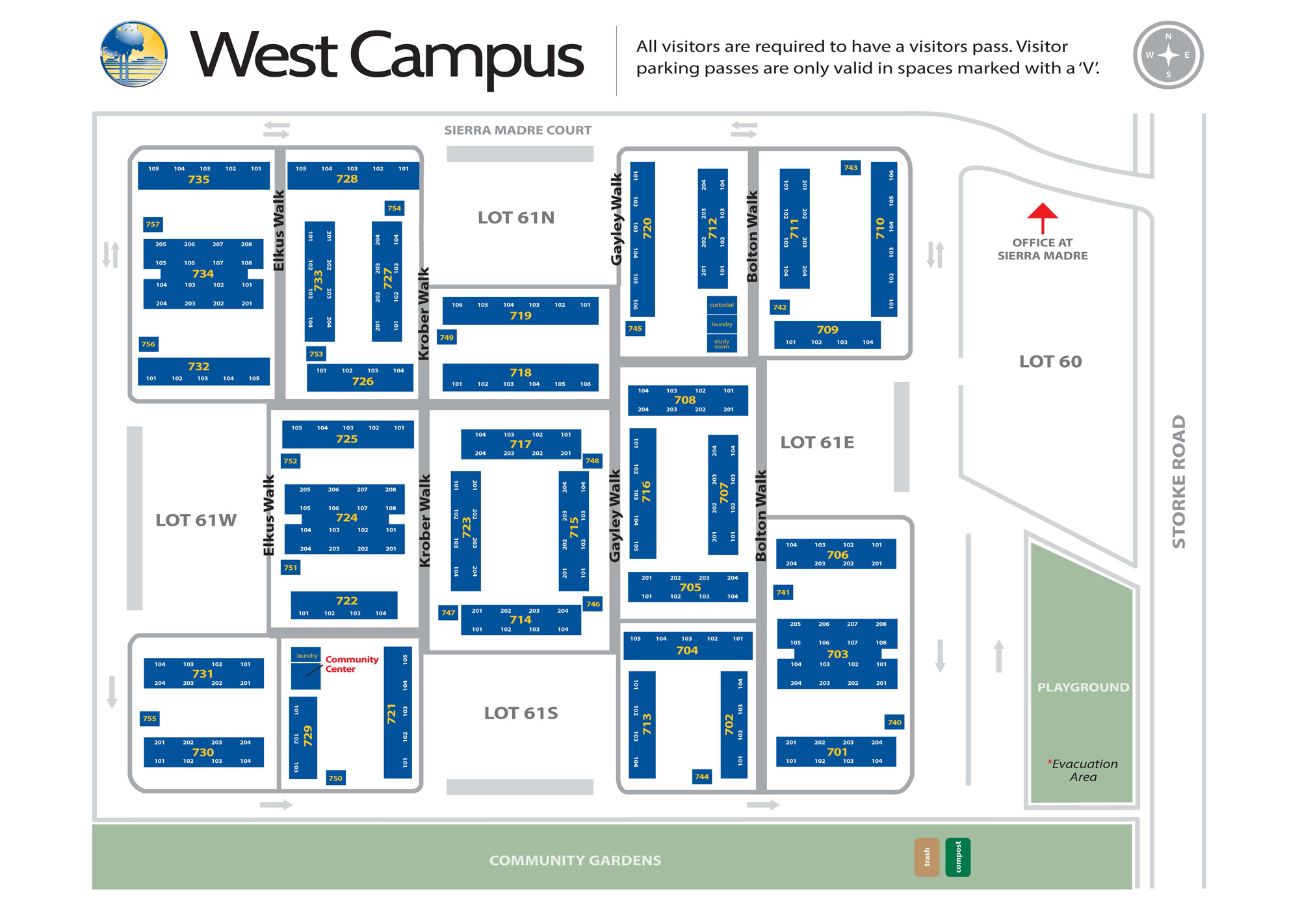
This layout map for West Campus Apartments at UC Santa Barbara provides a general layout plan of the residential complex, emphasizing building and unit numbers, pedestrian walkways, parking lots, and emergency resource locations.
Building Layout
The complex is organized into several clusters of residential buildings separated by named pedestrian walkways and parking lots:
- Named Walks: The primary pedestrian corridors are Elkus Walk, Krober Walk, Gayley Walk, and Bolton Walk.
- Parking Facilities: Residents and visitors have access to Lot 61N, Lot 61W, Lot 61S, and Lot 61E.
- Community Spaces: The complex features a central Community Center and Community Gardens located on the southern edge.
- Recreation: A Playground is situated on the southeastern side of the complex near Storke Road.
Campus Orientation
- North: Bordered by Sierra Madre Court.
- East: Bordered by Storke Road and Lot 60
- West: Bordered by North Campus Open Space
Emergency Evacuation Sites
The designated emergency assembly point for the complex is clearly marked
- Primary Evacuation Area: Residents should assemble at the large grassy area located directly adjacent to the Playground and west of Storke Road.
Visitor and Parking Information
- Passes Required: All visitors must have a visitor parking pass to avoid citation.
- Validation: These passes are only valid in parking spaces specifically marked with a 'V'.